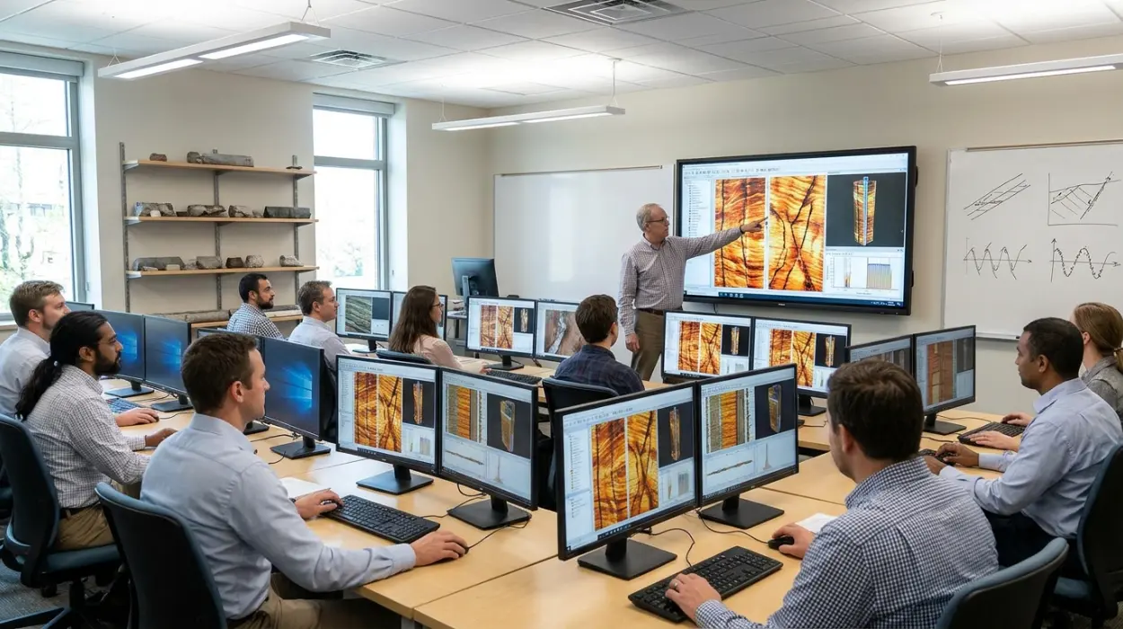
Subsurface characterization relies on high-resolution data to minimize drilling risk and optimize reservoir recovery. Conventional open-hole logs provide bulk physical measurements, yet they lack the azimuthal resolution required to resolve thin beds, complex fracture networks, and subtle stratigraphic features. Geoscientists and petrophysicists frequently encounter interpretation bottlenecks when raw electrical and acoustic borehole image data exhibit acquisition artefacts, speed variations, or pad-to-pad inconsistencies. Without standardized workflows, technical teams risk misidentifying structural dips, overestimating fracture porosity, or misinterpreting sedimentary facies. Understanding Why Borehole Image Processing Matters in Oil and Gas Well Log Analysis establishes the foundational context for subsurface asset teams before they commit capital to advanced workforce upskilling.
To bridge this technical capability gap, Institute For Oil & Gas Training delivers a specification-driven syllabus designed for operational accuracy. The Borehole Image Processing and Interpretation Training Course standardizes how asset teams handle raw downhole measurements, execute image log quality control, and extract reliable geological models. Rather than relying on automated software defaults, participants learn the physical principles governing tool responses in both conductive and resistive drilling fluids. This technical rigor ensures that exploration and production departments reduce geological uncertainty during well placement and field development planning.
What is the Borehole Image Processing and Interpretation Training Course and What Problem Does It Solve?
The Borehole Image Processing and Interpretation Training Course is an applied technical program designed by Institute For Oil & Gas Training to eliminate interpretation errors caused by uncalibrated borehole image logs, equipping geoscientists with standardized processing, structural analysis, and fracture characterization workflows.
Exploration and production organizations invest heavily in acquiring high-resolution micro-resistivity and ultrasonic borehole image logs. However, operational reviews frequently reveal a disconnect between data acquisition budgets and the quality of the final geological deliverables. Many asset teams treat processed image logs delivered by service companies as absolute geological truth without auditing the underlying processing parameters. When speed corrections fail or dynamic normalization masks true formation resistivity contrasts, interpreters introduce significant errors into static reservoir models.
The core workplace problem centres on inconsistent technical standards across multi-disciplinary subsurface teams. Junior geologists often struggle to differentiate drilling-induced tensile fractures from natural open fractures, leading to flawed geomechanical models and suboptimal hydraulic fracturing designs. Simultaneously, senior asset managers face difficulties benchmarking the technical competency of their petrophysical staff when evaluating complex carbonate or fractured basement reservoirs. Institute For Oil & Gas Training addresses these exact operational vulnerabilities by replacing ad-hoc software operation with deterministic, physics-based interpretation protocols.
Addressing the Subsurface Data Interpretation Deficit
Modern wellbores frequently traverse deviated trajectories, horizontal sections, and challenging borehole environments where tool eccentricity and stick-and-slip motion degrade data integrity. Without rigorous image log quality control, geometric distortions alter apparent dip magnitudes and azimuths. This course trains participants to diagnose acquisition anomalies at the raw curve level before executing spatial orientation corrections. By mastering these diagnostic routines, technical personnel prevent corrupted well data from propagating into field-wide structural maps and volumetric estimations.
Standardizing Cross-Departmental Technical Workflows
Subsurface evaluation requires seamless integration between petrophysics, structural geology, sedimentology, and reservoir engineering. When each discipline applies different classification schemes for bedding planes, faults, and vuggy porosity, project timelines stall during peer reviews. The curriculum establishes a unified lexicon and standardized confidence-ranking system for all picked geological features. HR directors and technical department heads utilize this framework to align global asset teams around identical reporting standards, ensuring seamless knowledge transfer across regional business units.
Why is This Borehole Image Training Course Structured This Way?
Institute For Oil & Gas Training structures this curriculum around a sequential, physics-first progression moving from raw acquisition quality control to advanced geological synthesis, ensuring participants master data conditioning before attempting complex structural analysis, FMI interpretation, or reservoir characterization.
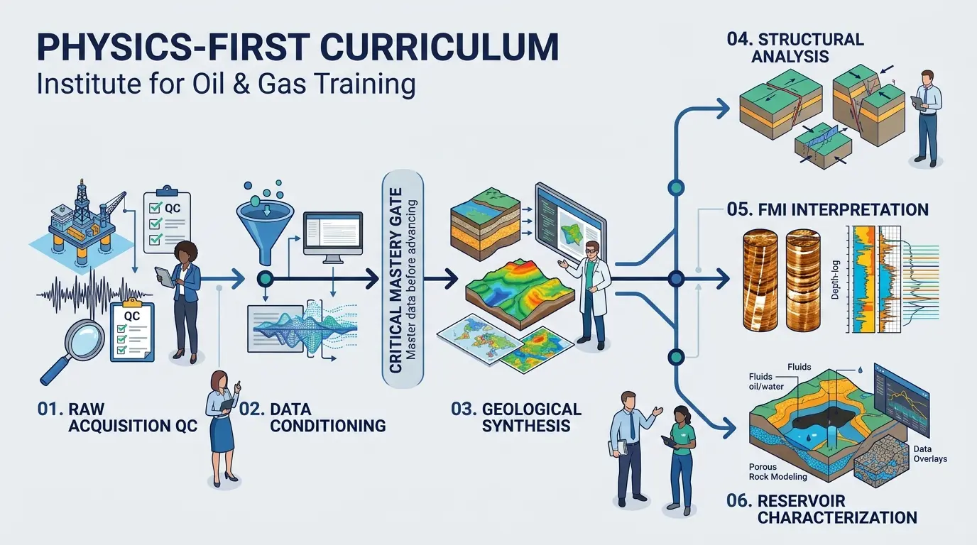
Technical training programs frequently fail when they prioritize software button-pushing over fundamental measurement physics. If an interpreter does not understand how button current penetration depth varies between water-based and oil-based mud systems, no amount of advanced visualization software will prevent misinterpretation. The syllabus architecture enforces a strict dependency model where each learning module builds directly upon the verified outputs of the preceding stage. Participants cannot advance to structural stereonet modeling until they demonstrate proficiency in accelerometer correction, inclinometer calibration, and pad image equalization.
When technical leads evaluate How to Process and Interpret Borehole Image Logs for Accurate Geological Evaluation, they require clear criteria to separate introductory awareness sessions from operational competency programs. The instructional design of Institute For Oil & Gas Training mirrors the actual lifecycle of a subsurface evaluation project. By replicating the exact sequence of tasks performed during a live well post-mortem or field study, the course eliminates the cognitive gap between classroom theory and workstation execution.
The Physics-Before-Software Pedagogical Sequence
Every module initiates with the governing physical equations and tool geometries before introducing workstation workflows. Participants examine electrode array configurations, acoustic transducer frequencies, and borehole coverage percentages across varying hole diameters. Understanding these physical boundaries enables interpreters to recognize the exact resolution limits of their datasets. Consequently, learners develop the critical judgment required to reject low-confidence features rather than over-interpreting artefacts as geological structures.
Progressive Complexity from Clastic to Fractured Reservoirs
Geological complexity scales systematically across the five-day instructional timeline. Early exercises utilize high-contrast siliciclastic sequences with clear planar bedding to establish baseline dip-picking mechanics and static versus dynamic normalization techniques. Once participants achieve high repeatability on straightforward stratigraphic intervals, the curriculum introduces structural complexities including faults, unconformities, and drag folds. The final stages transition into naturally fractured carbonates and basement lithologies, requiring participants to integrate fracture aperture calculations with in-situ stress orientation data.
What Will Participants Learn in the Borehole Image Processing and Interpretation Training Course?
Participants will master raw image log quality control, speed correction, static and dynamic normalization, FMI interpretation, OBMI interpretation, manual and automated dip picking, structural analysis, sedimentological facies classification, and quantitative fracture identification across diverse lithological settings.
The syllabus is divided into six technical modules, each mapped to specific workstation competencies and measurable analytical outputs. Rather than offering broad overviews, every session requires participants to manipulate real multi-well datasets, apply mathematical filters, and defend their geological interpretations using empirical evidence.
Module 1: Tool Physics, Acquisition Principles, and Image Log Quality Control
This foundational module establishes the physical parameters governing electrical and acoustic imaging tools. Participants analyze the operational differences between micro-resistivity devices in conductive muds and ultrasonic or micro-inductive devices in non-conductive fluids.
Tool Geometry and Coverage: Calculate borehole wall coverage percentages based on pad dimensions, arm counts, and caliper measurements across gauge and washed-out hole sections.
Navigation and Orientation Audits: Audit raw triaxial accelerometer and magnetometer curves to detect magnetic interference, tool sticking, and high-frequency rotation anomalies.
Image Log Quality Control: Execute systematic quality control checklists to flag dead buttons, pad lift-off, cycle skipping, and mudcake attenuation before initiating processing.
Module 2: Raw Data Conditioning and Image Processing Workflows
Participants learn to transform raw, uncalibrated tool arrays into spatially accurate, oriented borehole images suitable for quantitative geological analysis.
Speed Correction Algorithms: Apply accelerometer-derived velocity models to correct depth shifts caused by erratic tool movement and stick-and-slip events.
Equalization and Normalization: Execute pad-to-pad and button-to-button gain and offset corrections, distinguishing between static normalization for lithological trends and dynamic normalization for high-resolution textural detail.
Borehole Geometry and Orientation: Convert tool-referenced measurements into true geographic coordinates (True North) and calculate true stratigraphic thickness (TST) and true vertical depth (TVD).
Module 3: FMI Interpretation and OBMI Interpretation Methodologies
This module addresses the distinct processing and analytical requirements of conductive versus resistive borehole environments.
FMI Interpretation: Analyze high-resolution micro-resistivity responses in water-based muds, resolving thin-bedded sand-shale sequences, bioturbation textures, and cementation variations down to millimetre scales.
OBMI Interpretation: Process and interpret oil-based micro-imager datasets, accounting for lower spatial resolution, standoff effects, and capacitive coupling phenomena inherent to non-conductive drilling fluids.
Acoustic Image Integration: Combine ultrasonic transit-time and amplitude logs with electrical images to separate borehole wall geometry (breakouts, washouts) from true formation resistivity contrasts.
Module 4: Structural Analysis and Dip Classification
Participants develop deterministic workflows for extracting structural geometry and tectonic history from oriented sinusoidal traces.
Sinusoid Picking Mechanics: Differentiate true planar geological features from non-planar artefacts, apparent dips, and borehole-wall damage.
Stereonet and Tadpole Analysis: Construct Schmidt and Wulff stereographic projections, azimuth vector plots, and cumulative dip plots to identify structural domains, fold axes, and fault drag zones.
Fault and Unconformity Identification: Characterize normal, reverse, and strike-slip fault intersections using fracture intensity halos, abrupt dip rotations, and stratigraphic omission patterns.
Module 5: Fracture Identification and Geomechanical Characterization
This module focuses on separating natural fracture networks from drilling-induced features to support reservoir simulation and well completion design.
Fracture Classification: Distinguish conductive open fractures, resistive mineralized (healed) fractures, drilling-induced tensile fractures (DITFs), and borehole breakouts based on sinusoidal geometry and electrical character.
In-Situ Stress Determination: Map maximum and minimum horizontal stress orientations ($S_{Hmax}$ and $S_{hmin}$) using breakout azimuths and tensile fracture orientations across multi-well field datasets.
Quantitative Fracture Parameters: Compute fracture intensity (P10, P21, P32), fracture porosity, and hydraulic aperture using calibrated resistivity contrast equations.
Module 6: Sedimentological Facies and Reservoir Heterogeneity Modeling
The final module integrates borehole image textures with open-hole petrophysical logs and core data to construct predictive depositional models.
Core-to-Log Calibration: Align high-resolution core photographs with static and dynamic borehole images to establish electrofacies classification rules.
Palaeocurrent Analysis: Remove structural tilt via stereonet rotation to restore original depositional cross-bedding azimuths and determine sediment transport directions.
Carbonate Textural Analysis: Quantify secondary porosity components including vugs, moulds, stylolites, and karstic breccias in heterogeneous carbonate reservoirs.
How is the Borehole Image Processing and Interpretation Training Course Delivered?
Institute For Oil & Gas Training delivers this 40-hour program via instructor-led onsite workshops, live virtual classrooms, or hybrid corporate cohorts, combining rigorous theoretical briefings with workstation-based practical exercises and standardized technical assessments.
Operational schedules across global energy companies demand flexible training logistics that do not compromise workstation access or instructor supervision. Institute For Oil & Gas Training structures delivery formats to accommodate both individual technical specialists and intact corporate asset teams. Every delivery mode maintains identical instructional hours, dataset complexity, and assessment criteria to ensure uniform certification standards.
Delivery Format | Duration & Schedule | Workstation & Software Setup | Ideal Corporate Use Case |
Onsite Corporate Workshop | 5 consecutive days (8 hours/day) at client facility | Installed on client network or pre-configured training laptops | Upskilling entire regional exploration or asset development teams simultaneously |
Live Virtual Instructor-Led | 5 days (8 hours/day) or 10 half-days (4 hours/day) | Cloud-hosted virtual workstations with dual-monitor support | Geographically dispersed petrophysicists and geologists requiring zero travel downtime |
Hybrid Blended Cohort | Self-paced pre-work modules + 4 days live instructor workshops | Cloud workstation access + asynchronous LMS portal | Multi-disciplinary teams with varying baseline familiarity in log processing |
Practical Workstation Simulations and Dataset Complexity
Participants spend approximately 65 percent of total course hours working directly with real, unedited field datasets sourced from clastic, carbonate, and fractured basement reservoirs. Rather than working with sanitized textbook examples, learners process logs exhibiting severe stick-and-slip distortion, dead electrodes, and high-angle borehole trajectories. Instructors guide participants through step-by-step troubleshooting, demonstrating how parameter adjustments in normalization windows and speed-correction filters alter the resulting geological interpretation.
Assessment Methods and Competency Verification
To provide HR departments and technical managers with objective proof of skill acquisition, Institute For Oil & Gas Training enforces a multi-stage evaluation framework throughout the program:
Pre-Course Diagnostic Baseline: A 30-question technical assessment measuring baseline proficiency in log physics, coordinate transformations, and structural geology principles.
Module Checkpoints: Practical workstation exercises at the end of Modules 2, 4, and 5 requiring participants to submit processed image files and structural dip tables within specified tolerance limits.
Capstone Well Evaluation Project: A comprehensive final simulation where participants process a raw multi-zone dataset, generate a complete structural and fracture interpretation report, and present their findings to the instructional panel.
Final Competency Examination: A proctored written and practical examination requiring a minimum passing score of 80 percent to earn formal technical certification.
What Results Can Be Expected from This Training Program?
Organizations deploying this training achieve measurable reductions in well-log processing turnaround times, standardized structural and fracture reporting across asset teams, lower reservoir modeling uncertainty, and verified technical competency upgrades among geoscience personnel.
Training investments in upstream oil and gas operations must translate directly into improved subsurface decision-making and operational efficiency. When technical staff master standardized image processing workflows, organizations eliminate costly reliance on external consulting reviews for routine well evaluations. Asset teams gain the internal capability to audit third-party service deliverables immediately upon logging, catching acquisition or processing errors while the rig is still on location.
Measurable Workplace Impact and Role Effectiveness
Technical managers and HR leaders observe immediate operational improvements across three core performance indicators following course completion:
Reduction in Interpretation Cycle Time: Standardized processing templates and quality control checklists reduce the time required to move from raw DLIS file delivery to validated structural dip tadpoles by up to 40 percent.
Enhanced Cross-Disciplinary Alignment: Petrophysicists, structural geologists, and reservoir engineers utilize identical confidence rankings and fracture classification schemes, eliminating conflicting inputs during 3D static geomodel construction.
Improved Completion and Well Placement Outcomes: Accurate separation of open natural fractures from drilling-induced tensile fractures prevents horizontal wells from being steered into water-bearing fault zones or ineffective completion intervals.
Real-World Corporate Application Across Subsurface Departments
Consider a regional exploration and production department preparing to develop a structurally complex, naturally fractured carbonate field. Prior to training, the petrophysics team relied entirely on vendor-processed images, while the structural geology team manually picked dips without verifying speed corrections. This disconnected workflow produced conflicting fracture intensity maps, delaying well placement approvals.
By enrolling a cross-functional cohort of twelve petrophysicists, operations geologists, and reservoir engineers in the Borehole Image Processing and Interpretation Training Course, the department established a single unified workflow. Operations geologists now execute real-time image log quality control during logging runs, petrophysicists apply standardized FMI interpretation and OBMI interpretation parameters, and structural geologists generate validated stereonet models within 48 hours of logging completion. HR directors track these competency gains directly within corporate technical career ladders, linking course certification to senior geoscientist promotion criteria.
How Does Enrollment Work for the Borehole Image Processing and Interpretation Training Course?
Enrollment requires an undergraduate degree in geoscience or petroleum engineering plus basic well-log familiarity, following a streamlined four-step registration process managed by Institute For Oil & Gas Training for both individual professionals and corporate cohorts.
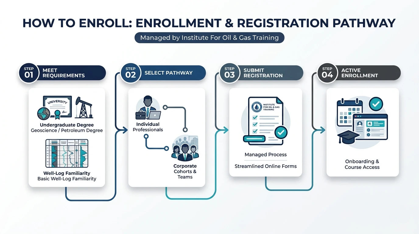
To maintain high instructional velocity during workstation exercises, Institute For Oil & Gas Training enforces strict prerequisite standards. This ensures that instructional hours focus entirely on advanced borehole image processing and geological interpretation rather than introductory petrophysical concepts.
Target Audience and Technical Prerequisites
This program is engineered specifically for upstream technical personnel responsible for subsurface characterization, well planning, and reservoir modeling:
Primary Roles: Petrophysicists, Exploration Geologists, Development Geologists, Operations Geologists, Structural Geologists, Sedimentologists, and Reservoir Engineers.
Academic Background: Bachelor of Science (BSc) or higher in Geology, Geophysics, Petroleum Engineering, or a closely related earth science discipline.
Technical Prerequisites: Working knowledge of standard open-hole wireline logs (gamma ray, resistivity, neutron, density, sonic) and fundamental structural geology concepts (strike, dip, apparent dip, stereographic projections). Prior experience with borehole image software is beneficial but not mandatory.
Step-by-Step Enrollment and Onboarding Path
Corporate training coordinators, HR business partners, and individual practitioners can complete registration through a transparent administrative sequence:
Cohort or Individual Seat Selection: Select either an upcoming open-enrolment virtual schedule for individual seats or request dedicated dates for an onsite or private virtual corporate cohort (minimum 6, maximum 16 participants per instructor).
Technical Prerequisite Verification: Submit participant role profiles or complete the brief online technical readiness check to confirm alignment with course prerequisites and workstation specifications.
Workstation Provisioning and Pre-Work Access: Seven days prior to course commencement, Institute For Oil & Gas Training distributes cloud workstation credentials, software installation guides (for onsite deliveries), and the pre-course diagnostic baseline assessment.
Program Execution and Certification Issuance: Complete the 40-hour instructional program, submit the capstone well evaluation project, and receive verifiable digital credentials and detailed competency scorecards for corporate HR records.
Technical teams and HR leaders ready to standardize their subsurface evaluation workflows and verify interpreter competency can review upcoming cohort dates and enrol in this program.
Frequently Asked Questions
What is Oil & Gas Borehole Imaging and how is it used in formation evaluation?
Oil & Gas Borehole Imaging generates high-resolution electrical or acoustic maps of the borehole wall to identify thin beds, structural dips, faults, and natural fracture networks. At Institute For Oil & Gas Training, specialists learn how these downhole visualisations bridge the resolution gap between conventional wireline logs and physical core samples to reduce reservoir uncertainty.
What is the difference between FMI and OBMI borehole imaging tools?
Fullbore Formation MicroImager (FMI) tools measure micro-resistivity in conductive water-based drilling muds, whereas Oil-Based MicroImager (OBMI) tools use capacitive coupling and micro-inductive electrodes to capture formation properties in non-conductive oil-based muds. Training programs at Institute For Oil & Gas Training cover the distinct processing and quality-control parameters required to interpret both datasets accurately.
How do geoscientists distinguish natural fractures from drilling-induced fractures on image logs?
Natural fractures typically appear as continuous, dark conductive or bright resistive sinusoids that cross the entire wellbore at varying dip angles, whereas drilling-induced tensile fractures form narrow, vertical, en-echelon cracks aligned 180 degrees apart along the maximum horizontal stress direction. Mastering this distinction through structured Oil & Gas Borehole Imaging instruction prevents geomechanical modelling errors and improves hydraulic fracturing designs.
Why is image log quality control necessary before structural dip interpretation?
Raw downhole image measurements frequently contain acquisition artefacts caused by tool stick-and-slip motion, pad lift-off, dead electrodes, and magnetic interference. Institute For Oil & Gas Training emphasizes rigorous speed correction, accelerometer calibration, and static or dynamic normalization so that apparent dips and structural azimuths reflect true subsurface geometry.
Who should enrol in Oil & Gas Borehole Imaging training courses?
Oil & Gas Borehole Imaging training is designed for petrophysicists, exploration geologists, development geologists, structural geologists, and reservoir engineers who evaluate complex clastic, carbonate, or fractured reservoirs. Institute For Oil & Gas Training equips subsurface asset teams with standardized workstation workflows to audit service-company deliverables and build reliable static reservoir models.
Related training courses
Borehole Image Logs for Fracture Detection Training Course
- Specialisation
- Oil & Gas Borehole Imaging
- Duration
- 5 days · 15 CPD hours
Borehole Image Applications in Sedimentology Training Course
- Specialisation
- Oil & Gas Borehole Imaging
- Duration
- 5 days · 15 CPD hours
Borehole Image Applications for Reservoir Characterization Training Course
- Specialisation
- Oil & Gas Borehole Imaging
- Duration
- 5 days · 15 CPD hours
More articles
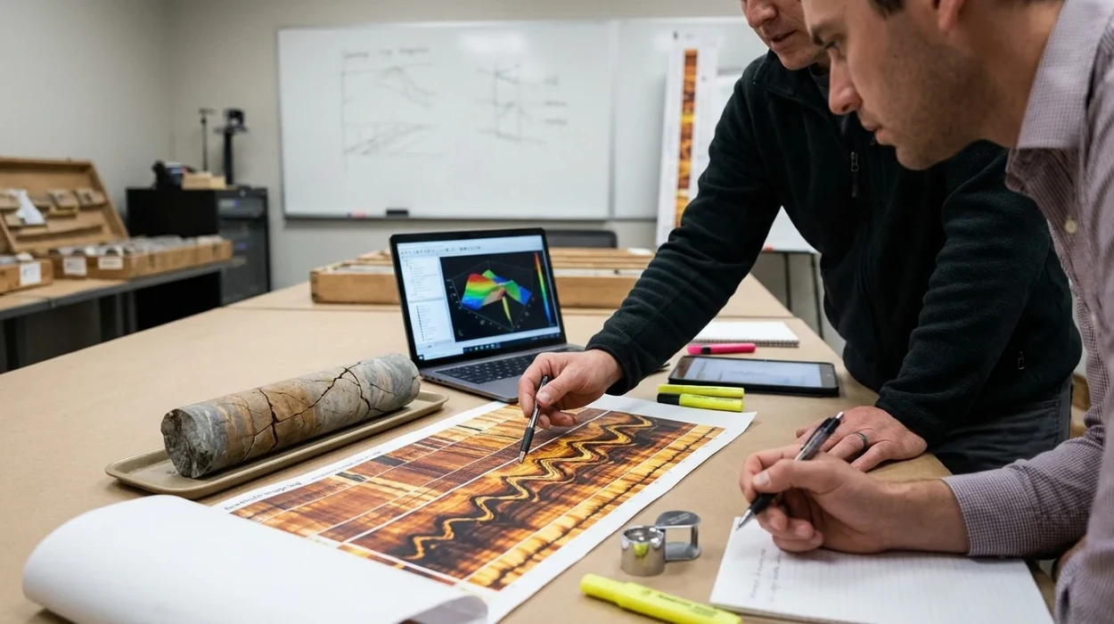
Borehole Image Logs for Fracture Detection Training by Institute For Oil & Gas Training
Evaluate and enrol in the Borehole Image Logs for Fracture Detection Training Course by Institute For Oil & Gas Training. Master subsurface fracture analysis.
Read article →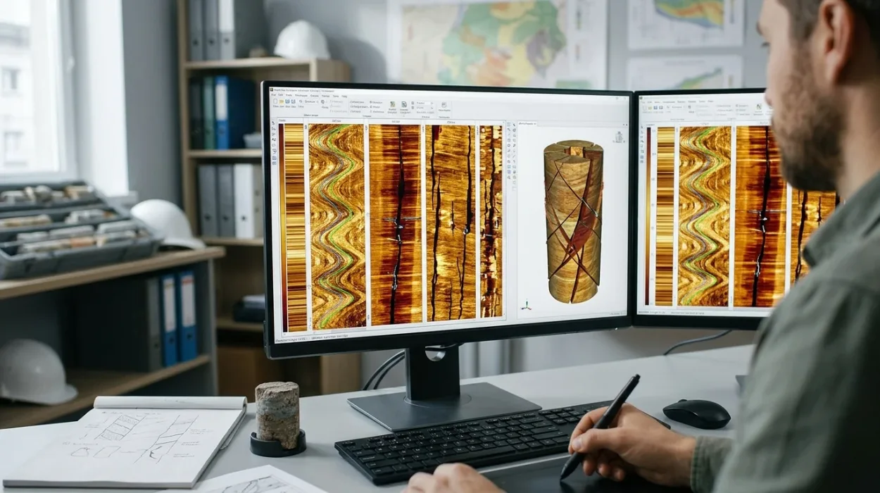
How to Identify and Evaluate Natural and Induced Fractures Using Borehole Image Logs
Compare methodologies for natural fracture identification and induced fracture evaluation using borehole image interpretation in carbonate reservoirs to upskill teams.
Read article →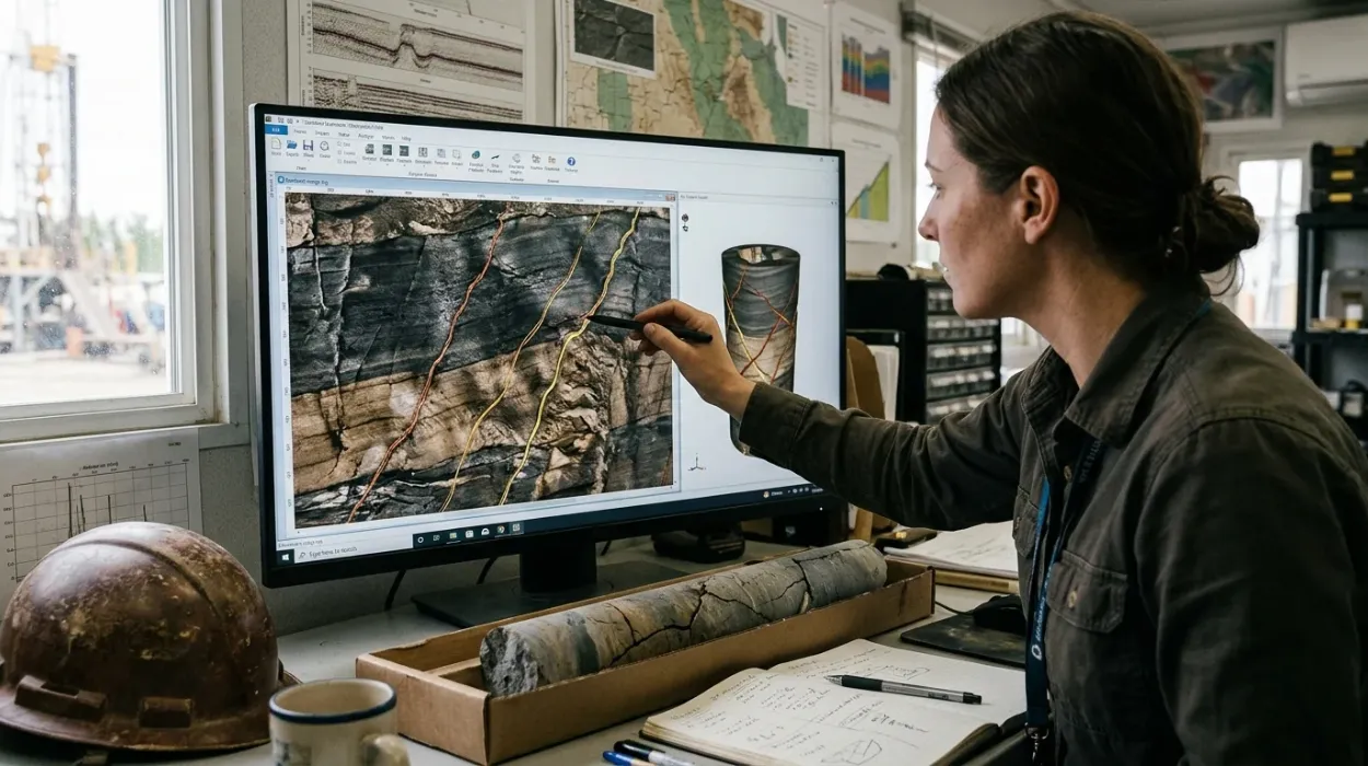
Why Borehole Image Logs Are Important for Fracture Detection
Discover how corporate training in borehole image logs closes subsurface skill gaps, reduces non-productive time, and drives reservoir characterisation ROI.
Read article →