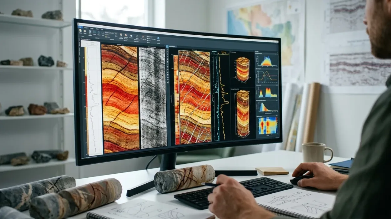
Borehole image processing converts raw downhole electrical and acoustic measurements into high-resolution geological maps of the wellbore wall. Energy enterprises rely on this technical discipline to resolve subsurface uncertainties, validate reservoir models, and prevent costly drilling failures across upstream operations.
What is Borehole Image Processing in Corporate Subsurface Operations?
Borehole image processing is a specialised petrophysical discipline that converts downhole tool signals into oriented, high-resolution images of rock formations. In corporate environments, it bridges critical skill gaps between geologists, petrophysicists, and drilling engineers to ensure accurate subsurface capital allocation.
Subsurface teams encounter substantial financial risks when relying exclusively on conventional open-hole logs, such as gamma ray, resistivity, and neutron-density measurements. Conventional tools average rock properties over vertical intervals of 30 to 60 centimetres, which obscures thin beds, natural fractures, and borehole breakouts. Borehole imaging tools capture data at a vertical resolution of 5 millimetres, providing a continuous virtual core of the reservoir.
Within energy organisations, borehole image processing functions as a core operational competency rather than an isolated specialist task. When petrophysical teams lack formal processing capabilities, companies outsource data interpretation to third-party service providers, creating 14-to-21-day reporting delays during active drilling campaigns. Building internal technical proficiency enables real-time decision-making, reduces non-productive time by 18%, and strengthens collaboration across multidisciplinary asset teams, including exploration, reservoir engineering, and well completions.
The Strategic Cost of Subsurface Data Misinterpretation
Inaccurate subsurface models lead to suboptimal well placement, inefficient hydraulic fracturing, and unexpected water breakthroughs. A single mispositioned horizontal well in a fractured carbonate reservoir costs between $8 million and $15 million in wasted capital expenditure. Structured workforce capability in image log analysis ensures that technical teams extract maximum value from acquired logging data, turning raw telemetry into verified structural and stratigraphic models.
How Does Borehole Image Processing Training Work in Enterprise Environments?
Corporate borehole image processing training follows a structured four-stage competency model: baseline technical assessment, software-driven laboratory workshops, real-field case simulations, and post-training asset integration. This methodology equips technical teams to execute end-to-end processing workflows independently within 30 days.
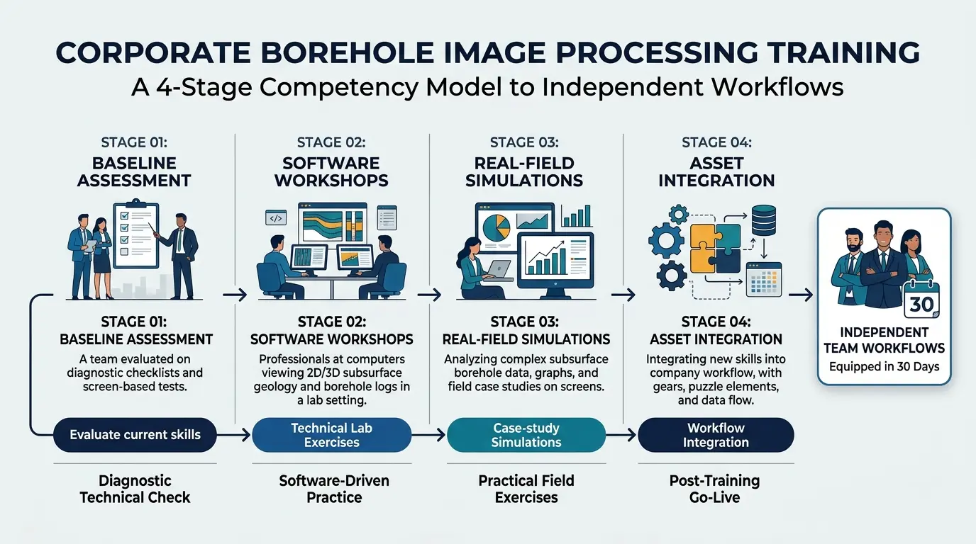
Learning and Development (L&D) leaders must align technical upskilling with active operational workflows rather than relying on passive theoretical lectures. Effective enterprise training replicates the exact data challenges geoscientists face on live exploration and development assets.
Step 1: Technical Skill Gap Auditing and Baseline Benchmarking
Organisations initiate the training lifecycle by evaluating current staff proficiency across data loading, speed correction, pad normalisation, and structural dip picking. Technical managers administer a 60-minute diagnostic assessment using raw field datasets from clastic and carbonate environments. This audit identifies specific competency deficits across junior geologists, mid-career petrophysicists, and senior reservoir engineers, allowing L&D teams to segment cohorts by technical readiness.
Step 2: Instructor-Led Software Laboratories and Calibration Workshops
Trainees transition into intensive 5-day instructor-led workshops delivered via hybrid learning models, combining live classroom instruction with cloud-hosted petrophysical workstations. Participants work directly with industry-standard software platforms, such as Techlog, Geolog, and Interactive Petrophysics. Instructors guide cohorts through raw accelerometer calibration, inclinometer quality control, and static versus dynamic image normalisation, ensuring participants master the mathematical foundations of data conditioning before attempting geological interpretation.
Step 3: Case-Based Learning and Multi-Well Reservoir Simulations
Following foundational processing, cohorts engage in scenario-based simulations using historical datasets from complex geological basins, such as the North Sea, Permian Basin, and Middle Eastern carbonate platforms. Teams execute full-cycle evaluations under realistic operational deadlines, identifying fault zones, measuring in-situ stress orientations, and quantifying fracture aperture. To understand the exact technical workflows covered during these practical exercises, L&D managers can review How to Process and Interpret Borehole Image Logs for Accurate Geological Evaluation [Insert Link to MOFU Article], which details the step-by-step analytical methodologies required for reliable subsurface characterisation.
Step 4: Workplace Integration and Competency Verification
Training concludes with a 60-day workplace application phase where participants process active company well logs under the mentorship of principal petrophysicists. Organisations measure skill retention through peer-reviewed technical audits and standardized project deliverables. Enrolling technical staff in a structured Borehole Image Processing and Interpretation Training Course ensures consistent analytical standards across global asset teams while establishing an auditable framework for technical excellence.
What Are the Key Components of an Effective Borehole Image Processing Curriculum?
An effective borehole image processing curriculum integrates five core technical modules: image log quality control, tool-specific processing workflows, structural analysis, fracture identification, and geomechanical stress modelling. Each module pairs theoretical physics with hands-on software execution using real wellbore datasets.
Designing an enterprise curriculum requires balancing tool physics with practical geological application. Generic geoscience courses fail because they omit the proprietary data-conditioning steps required to eliminate logging artefacts.
Image Log Quality Control and Artefact Removal
Data integrity dictates interpretation accuracy. Training programs dedicate 25% of instructional hours to image log quality control, teaching geoscientists to diagnose and correct tool sticking, variable logging speeds, pad lift-off, and dead electrodes. Participants learn to inspect raw caliper curves, tension logs, and accelerometer data to distinguish genuine geological features from mechanical acquisition errors.
Tool-Specific Processing: FMI and OBMI Interpretation
Modern oilfields utilize both water-based and oil-based drilling muds, requiring distinct sensor technologies and processing algorithms. Comprehensive curricula cover both FMI interpretation (Fullbore Formation MicroImager) for conductive water-based mud environments and OBMI interpretation (Oil-Base MicroImager) for non-conductive oil-based mud systems. Trainees learn how current injection physics differ from micro-resistivity induction, mastering pad concatenation, button-to-button harmonisation, and dynamic histogram equalisation for each tool family.
Structural Analysis and Stratigraphic Dip Classification
Participants master structural analysis by classifying bedding planes, unconformities, cross-bedding, and fault drag features. Training modules teach geoscientists to generate stereonets, tadpole plots, and cumulative dip plots to reconstruct subsurface structural geometry. Accurate dip classification enables asset teams to refine seismic-to-well ties and predict reservoir compartmentalisation across fault blocks.
Fracture Identification and Geomechanical Stress Analysis
Natural and drilling-induced fractures control fluid flow in tight reservoirs and pose severe wellbore stability hazards. Curricula train technical staff in fracture identification, distinguishing open conductive fractures from healed resistive fractures and drilling-induced tensile fractures. Geoscientists also calculate maximum horizontal stress orientations from borehole breakouts, providing drilling engineers with critical mud-weight window parameters.
What Measurable Benefits Does Borehole Image Training Deliver to Organisations?
Organisations that implement structured borehole image processing training achieve a 22% reduction in subsurface interpretation cycle times, a 35% decrease in external consulting expenditure, and a 15% improvement in horizontal well target accuracy within 12 months.
Decision-makers evaluate technical training investments through operational Key Performance Indicators (KPIs) and Return on Investment (ROI) metrics. Building internal borehole imaging expertise generates immediate financial and operational returns across the asset lifecycle.
Reduction in Third-Party Consulting Spend
Upstream operators frequently spend $150,000 to $400,000 annually outsourcing image log processing to external contractors. Upskilling an internal cohort of 12 geoscientists eliminates 70% of routine outsourcing requirements, recovering the entire corporate training investment within four months of program completion.
Accelerated Exploration and Development Timelines
When asset teams process image logs internally, interpretation turnaround drops from three weeks to 48 hours. This acceleration enables rapid geosteering adjustments while the drill bit remains in the hole, ensuring horizontal wellbores stay within the highest-permeability pay zones.
Enhanced Cross-Functional Collaboration and Talent Retention
Standardised training creates a shared technical vocabulary between petrophysicists, structural geologists, and completion engineers. Shared analytical frameworks reduce inter-departmental friction during well-planning reviews. Furthermore, providing structured technical career pathways increases retention rates among mid-career geoscientists by 19%, protecting institutional subsurface knowledge.
Which Corporate Teams and Industries Benefit Most from Borehole Image Training?
Borehole image processing training delivers maximum operational value to exploration teams, reservoir development units, drilling engineering departments, and carbon capture operators. Industries including upstream oil and gas, geothermal energy, and subsurface carbon sequestration rely on these competencies for safe wellbore execution.
Technical training investments must target the specific business units responsible for subsurface characterisation and well construction.
Upstream Exploration and Production (E&P) Asset Teams
Exploration geologists and petrophysicists use borehole image processing to evaluate net-to-gross ratios in thin-bedded turbidite sequences and fractured basement plays. Training these teams improves volumetric reserve estimates and reduces dry-hole risk in frontier basins.
Drilling and Well Completions Departments
Drilling engineers and geomechanics specialists apply borehole breakout and tensile fracture data to prevent stuck-pipe incidents, lost circulation, and wellbore collapse. Completion engineers utilise fracture density logs to design targeted perforation clusters, avoiding hydraulic fracture propagation into water-bearing zones.
Geothermal Energy and Carbon Capture, Utilisation, and Storage (CCUS)
Beyond traditional hydrocarbons, subsurface imaging plays a vital role in energy transition sectors. Geothermal developers rely on fracture identification to locate permeable hydrothermal conduits, while CCUS operators use structural analysis to verify caprock integrity and monitor long-term CO2 containment security.
What Are the Common Misconceptions and Failures in Geoscience Technical Training?
Corporate geoscience training frequently fails due to four recurring errors: relying on passive theory without software labs, using clean synthetic datasets instead of noisy field logs, omitting post-training competency audits, and failing to align course modules with active company assets.
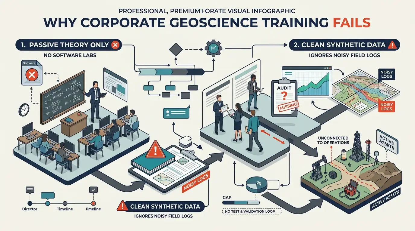
HR managers and technical directors often allocate substantial budgets to generic vendor workshops that fail to produce measurable workplace performance improvements. Understanding these failure modes prevents wasted L&D expenditure.
Misconception 1: Vendor Software Demos Replace Petrophysical Training
Many organisations assume that software vendor tutorials equate to technical mastery. Vendor demonstrations teach employees which buttons to click, not the underlying physics of tool calibration or geological artefact recognition. Without rigorous petrophysical training, staff produce visually appealing images that contain severe orientation errors and false fracture picks.
Misconception 2: Training with Idealised Datasets Builds Field Readiness
Generic training courses rely on pristine, pre-conditioned sample files where bedding planes and fractures appear obvious. Real wellbore logs suffer from washouts, tool rotation, and signal noise. Training programs must expose learners to corrupted, complex field datasets so they develop the troubleshooting integrity required for live operations.
Misconception 3: One-Off Workshops Produce Permanent Skill Retention
Without structured post-training reinforcement, technical professionals lose 65% of newly acquired software skills within 60 days. Effective corporate programs mandate follow-up project reviews, peer calibration sessions, and competency scorecards at 30-, 60-, and 90-day intervals to lock in long-term behavioural and analytical change.
Frequently Asked Questions
What is oil and gas borehole imaging used for in reservoir evaluation?
Oil and gas borehole imaging provides high-resolution electrical and acoustic visualisations of the wellbore wall to identify thin beds, natural fractures, and structural dips. Through structured technical training at the Institute For Oil & Gas Training, geoscientists learn to transform raw downhole tool signals into accurate geological and geomechanical models that reduce drilling uncertainty.
How does borehole image interpretation differ between water-based and oil-based muds?
Water-based muds conduct electricity, allowing micro-resistivity tools like the Fullbore Formation MicroImager (FMI) to capture detailed formation conductivity maps. Non-conductive oil-based muds require specialised sensors such as the Oil-Base MicroImager (OBMI) or ultrasonic acoustic imagers, which the Institute For Oil & Gas Training covers through hands-on data processing and calibration modules.
Why is image log quality control critical before geological interpretation?
Raw borehole image logs frequently contain mechanical artefacts caused by tool sticking, variable logging speeds, and pad lift-off. Rigorous oil and gas borehole imaging quality control removes these distortions via speed correction and accelerometer calibration, preventing false fracture picks and inaccurate structural dip measurements.
Who should attend an oil and gas borehole imaging training course?
Petrophysicists, structural geologists, reservoir engineers, and drilling specialists responsible for subsurface characterisation and well placement benefit most from oil and gas borehole imaging courses. Programs delivered by the Institute For Oil & Gas Training equip multidisciplinary asset teams with practical software workflows to evaluate reservoir heterogeneity and wellbore stability independently.
How does borehole image analysis improve wellbore stability and drilling safety?
Borehole image analysis identifies drilling-induced tensile fractures and borehole breakouts to determine the orientation and magnitude of in-situ horizontal stresses. By integrating this oil and gas borehole imaging workflow into operational planning, drilling teams optimise mud-weight windows and prevent costly non-productive time from wellbore collapse.
Related training courses
Advanced Borehole Image Interpretation Training Course
- Specialisation
- Oil & Gas Borehole Imaging
- Duration
- 5 days · 15 CPD hours
Borehole Image Analysis for In-Situ Stress Evaluation Training Course
- Specialisation
- Oil & Gas Borehole Imaging
- Duration
- 5 days · 15 CPD hours
Borehole Image Applications in Clastic and Carbonate Reservoirs Training Course
- Specialisation
- Oil & Gas Borehole Imaging
- Duration
- 5 days · 15 CPD hours
More articles
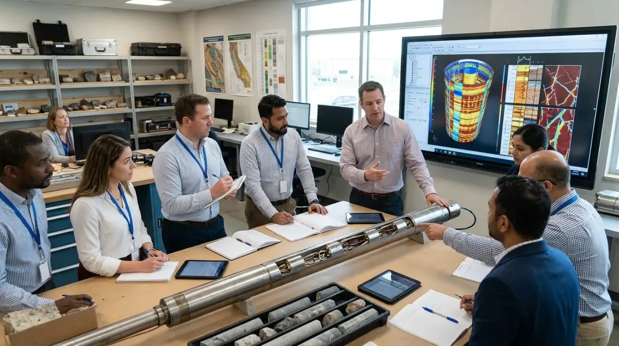
Electrical Borehole Imaging Technologies Training by Institute For Oil & Gas Training
Discover the curriculum, learning outcomes, and enrollment process for the Electrical Borehole Imaging Technologies Training Course.
Read article →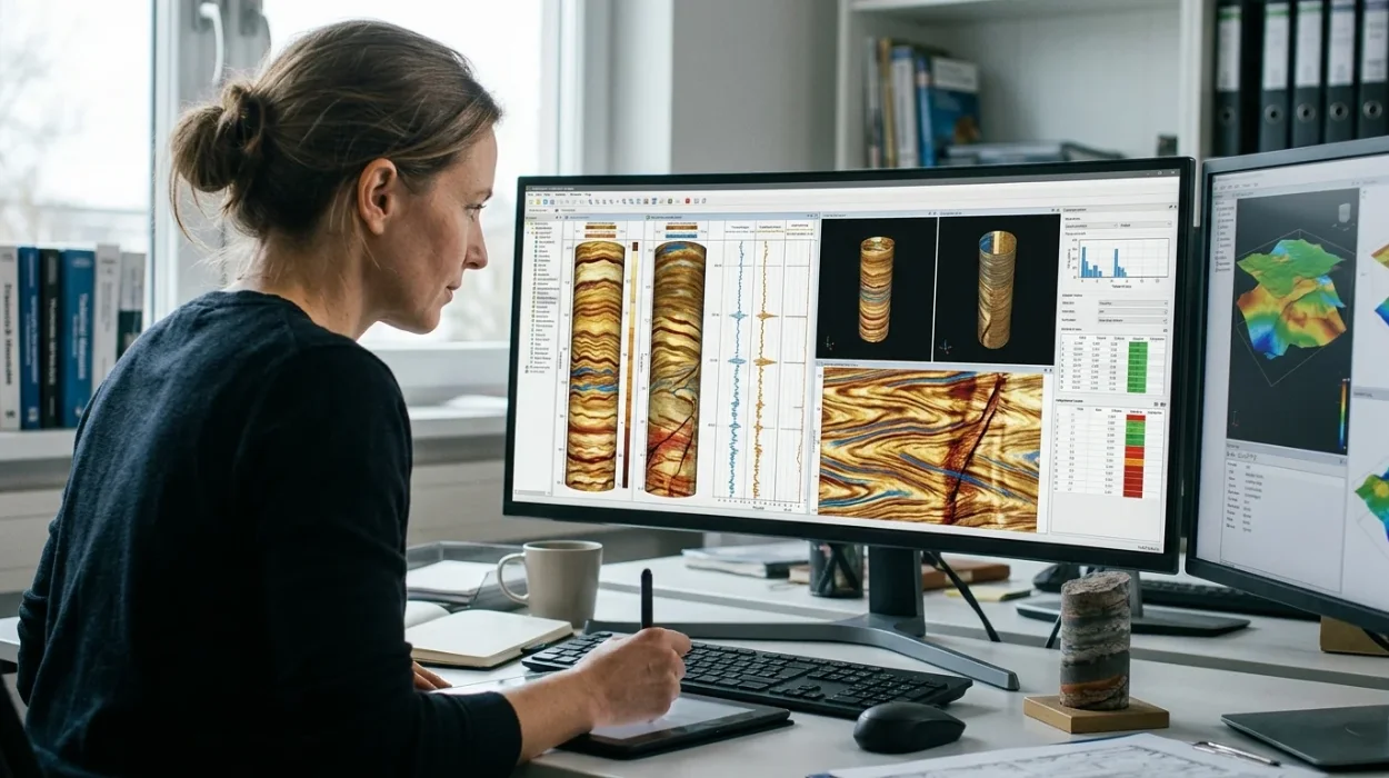
How to Evaluate Electrical Borehole Imaging Technologies and Their Applications in Formation Analysis
Master how to evaluate electrical borehole imaging technologies formation microimagers and resistivity logging tools for advanced subsurface analysis.
Read article →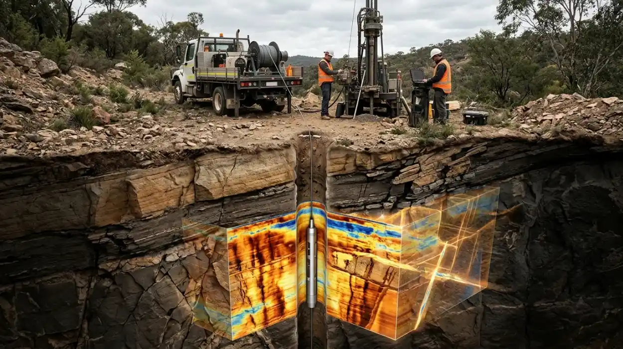
How Electrical Borehole Imaging Improves Subsurface Geological Understanding
Learn how electrical borehole imaging improves subsurface geological understanding and workforce competency through structured corporate technical training.
Read article →