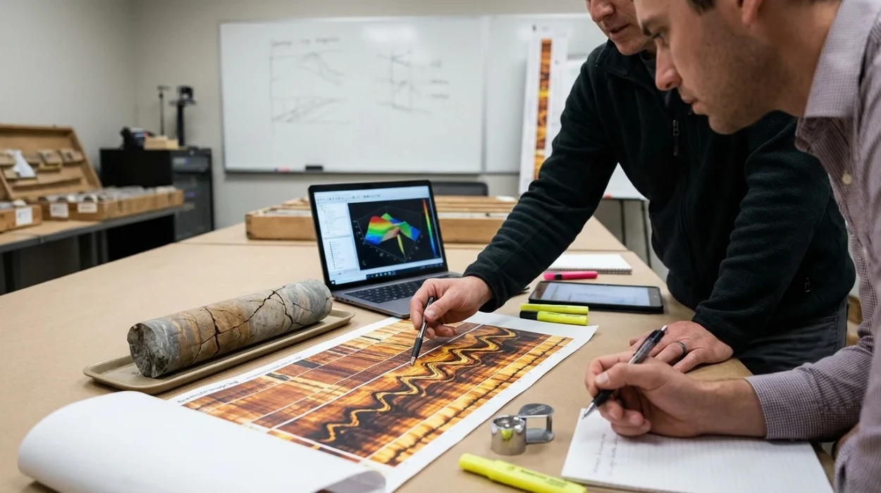
Subsurface engineering teams frequently miscalculate reservoir permeability and drilling risks due to inaccurate borehole image interpretation. Conventional open-hole logs lack the vertical resolution required to detect thin structural discontinuities within complex formations. Institute For Oil & Gas Training addresses this technical deficit through a specification-driven curriculum focused on high-resolution acoustic and electrical image analysis. Before committing to advanced operational training, technical teams often examine Why Borehole Image Logs Are Important for Fracture Detection to establish baseline geological relevance. This training syllabus outlines the operational scope, competency progression, and enrolment requirements for technical professionals and corporate learning departments.
What Is the Borehole Image Logs for Fracture Detection Training Course and What Problem Does It Solve?
The Borehole Image Logs for Fracture Detection Training Course is a technical corporate training program that resolves subsurface uncertainty by equipping geologists and engineers with standardized workflows to distinguish conductive, resistive, natural, and drilling-induced fractures across complex carbonate and clastic reservoirs.
Exploration and production departments face severe financial losses when wellbore stability models rely on incomplete structural data. Standard triple-combo logging suites average formation properties over thick intervals, masking narrow fracture apertures that govern fluid flow and lost circulation events. Institute For Oil & Gas Training designed this program to eliminate guesswork during well completion, hydraulic fracturing design, and field development planning.
Operational Skill Gaps in Subsurface Teams
Geoscientists and petrophysicists often struggle to separate geological fractures from mechanical wellbore failures caused by drilling operations. Misinterpreting drilling-induced tensile fractures as natural permeable networks leads to flawed reservoir simulations and suboptimal well placement. Human resources and technical team leads identify this analytical gap during post-drill reviews when actual production rates deviate from geological models.
Technical Scope of the Training Program
The curriculum establishes strict diagnostic protocols for processing raw borehole televiewer and micro-resistivity datasets into calibrated structural models. Participants learn to apply dip-picking algorithms, image normalization techniques, and fracture aperture calculations using industry-standard workstation methodologies. By standardizing borehole image interpretation across multidisciplinary asset teams, Institute For Oil & Gas Training ensures consistent reporting from wellsite operations to executive reservoir management.
Why Is This Course Structured Around Progressive Technical Competency?
This curriculum follows a sequential progression from tool physics and data quality control to advanced structural modeling, ensuring participants master foundational image calibration before executing complex natural fracture identification and geomechanical stress evaluations in active reservoir environments.
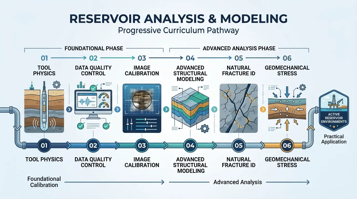
Technical training fails when instructors introduce advanced geological modeling before participants understand sensor limitations and borehole environmental artifacts. Institute For Oil & Gas Training structures its syllabus around cognitive load management and operational sequence. Each module builds directly upon the validated outputs of the preceding stage, mirroring real-world petrophysical workflows.
Alignment with Subsurface Decision Workflows
Asset teams must validate raw log quality before picking structural dips or calculating fracture porosity. Jumping directly into reservoir characterization without correcting for tool eccentering, stick-and-pull artifacts, or mud resistivity variations corrupts downstream engineering decisions. When evaluating internal training standards, technical managers often review guides on How to Identify and Evaluate Natural and Induced Fractures Using Borehole Image Logs to verify that course modules match field realities.
Integration of Corporate Learning Methodologies
The instructional architecture combines theoretical physics with immediate software-based execution to prevent knowledge decay. Corporate learning and development managers require verifiable skill transfer rather than passive lecture attendance. Institute For Oil & Gas Training enforces checkpoint assessments at the end of every module so learners demonstrate technical accuracy before advancing to multi-well correlation exercises.
What Will Participants Learn in the Course Modules?
Participants will master borehole image processing, quality control, structural dip classification, natural fracture identification, induced fracture stress mapping, and fracture aperture quantification across six structured modules designed for immediate application in carbonate reservoirs and fractured basement plays.
The syllabus breaks down complex petrophysical operations into discrete, measurable competencies. Every module targets a specific analytical deliverable required by subsurface asset teams during exploration, appraisal, and development phases.
Module 1: Physics of Electrical and Acoustic Imaging Tools
Learners examine the operational principles of micro-resistivity pad devices and ultrasonic borehole televiewers in water-based and oil-based mud systems. The module covers pad coverage calculations, vertical resolution limits, and depth of investigation parameters. Participants diagnose tool malfunction signatures, pad standoff effects, and velocity-induced image distortion to establish strict quality control baselines prior to interpretation.
Module 2: Raw Data Processing and Image Normalization
This section focuses on converting raw field data into static and dynamic normalized images suitable for geological analysis. Technicians execute accelerometer corrections, speed corrections, and pad-to-pad gain equalization. Learners configure dynamic normalization windows to highlight subtle bedding features while preserving static color scales for accurate lithological contrast comparisons.
Module 3: Structural Dip Classification and Sedimentary Features
Participants differentiate primary sedimentary structures—such as cross-bedding, unconformities, and lamination—from secondary tectonic deformation. The curriculum trains geoscientists to plot tadpole diagrams, stereonets, and azimuth vector plots to determine structural dip trends and fold axes. Accurate structural dip removal enables precise restoration of paleo-transport directions and true stratigraphic thickness calculations.
Module 4: Natural Fracture Identification and Classification
The core analytical module trains specialists in natural fracture identification, distinguishing open conductive fractures from mineralized resistive fractures. Learners analyze sinusoid geometry across borehole walls to calculate true dip angle and fracture orientation. Special emphasis is placed on carbonate reservoirs, where vuggy porosity, stylolites, and karst features interact with tectonic fracture networks to control primary permeability pathways.
Module 5: Induced Fractures and In-Situ Stress Analysis
Engineers and geologists evaluate induced fractures and borehole breakouts to construct comprehensive one-dimensional geomechanical earth models. Participants map the orientation of drilling-induced tensile fractures to determine maximum horizontal stress directions. Understanding stress regimes allows drilling teams to optimize mud weight windows, prevent wellbore collapse, and design effective hydraulic stimulation stages.
Module 6: Fracture Density, Aperture, and Permeability Modeling
The final technical module translates visual image picks into quantitative reservoir parameters for dynamic simulation. Learners compute fracture frequency, fracture intensity (P10, P21, P32), and hydraulic aperture using electrical conductivity equations. Participants integrate image-derived fracture logs with core data, mud loss records, and production logging tools to calibrate dual-porosity reservoir models.
How Is the Course Delivered and Assessed?
Institute For Oil & Gas Training delivers this program through instructor-led workshops, live virtual classrooms, and customized onsite corporate cohorts, utilizing practical workstation exercises, blind dataset evaluations, and simulation-based competency assessments to verify technical mastery.
Corporate training schedules must accommodate active operational rosters without disrupting ongoing drilling campaigns. Institute For Oil & Gas Training provides flexible deployment architectures while maintaining identical technical rigor across all delivery channels.
Training Delivery Formats
Organizations select from three structured delivery models based on team distribution and operational urgency:
Onsite Corporate Cohorts: Conducted at the client facility over five consecutive days, utilizing proprietary company well logs to solve active field challenges.
Live Virtual Instructor-Led Training: Delivered across ten half-day sessions via cloud-hosted petrophysical workstations, allowing global asset teams to participate without travel downtime.
Public Scheduled Workshops: Hosted at regional energy hubs, enabling individual specialists to benchmark their analytical workflows against peers from multiple operating companies.
Practical Simulation and Workstation Exercises
Lectures occupy less than thirty percent of total contact hours. Participants spend seventy percent of course duration interpreting actual multi-well datasets from fractured carbonate reservoirs, clastic sequences, and tight gas formations. Exercises replicate real-world time constraints, requiring learners to process raw logs, pick structural events, and submit standardized interpretation reports within operational deadlines.
Competency Assessment Methods
Institute For Oil & Gas Training replaces traditional multiple-choice quizzes with practical performance evaluations:
Diagnostic Calibration Tests: Learners identify intentional processing errors and tool artifacts embedded within synthetic log files.
Blind Dataset Interpretation: Participants independently evaluate an unlabelled borehole image dataset, submitting dip logs, stereonets, and stress orientation summaries for instructor grading.
Final Technical Defense: Each candidate presents a complete fracture characterization workflow to a senior petrophysical instructor, defending their differentiation between natural and induced fractures.
What Measurable Results Can Organizations Expect?
Organizations deploying this training achieve standardized borehole image interpretation across asset teams, reducing non-productive drilling time, improving well completion targeting, and establishing clear technical competency benchmarks for HR leadership pipelines and subsurface engineering departments.
Training investment must yield quantifiable operational improvements and verifiable workforce capability growth. When technical teams apply consistent borehole image interpretation standards, upstream operators observe immediate improvements in subsurface risk mitigation.
Subsurface Engineering and Operational Impact
Asset teams trained by Institute For Oil & Gas Training demonstrate measurable reductions in structural interpretation variance between interpreters. Accurate identification of high-permeability fracture corridors enables completion engineers to isolate water-producing zones and target productive intervals during perforation design. Drilling departments utilize validated geomechanical stress profiles to mitigate differential sticking and lost circulation incidents in overpressured zones.
Corporate HR and Workforce Transformation Outcomes
Human resources directors and technical training managers gain structured competency metrics for workforce planning and career progression:
Standardized Skill Benchmarking: HR teams receive granular assessment scores mapping each participant's proficiency in data quality control, structural picking, and geomechanical analysis.
Cross-Disciplinary Alignment: Geologists, petrophysicists, and drilling engineers establish a shared technical vocabulary, eliminating communication bottlenecks during well planning meetings.
Accelerated Talent Readiness: Junior and mid-level geoscientists acquire structured diagnostic workflows that typically require years of trial-and-error field experience, strengthening internal technical leadership pipelines.
Real-World Departmental Application
Consider a regional exploration department experiencing recurring lost circulation events while drilling horizontal wells through fractured carbonate reservoirs. Following cohort enrollment with Institute For Oil & Gas Training, the asset team re-evaluated offset borehole image logs using standardized normalization and fracture aperture protocols. The team identified a previously unrecognized set of critically stressed open fractures oriented parallel to maximum horizontal stress, allowing drilling engineers to adjust well azimuths and reduce non-productive time across subsequent development wells.
How Does Enrolment Work for Individuals and Corporate Teams?
Prospective participants and corporate training coordinators complete enrolment by verifying technical prerequisites, selecting a preferred delivery schedule, and submitting registration documentation through the official course portal to secure workstation access and pre-course calibration materials.
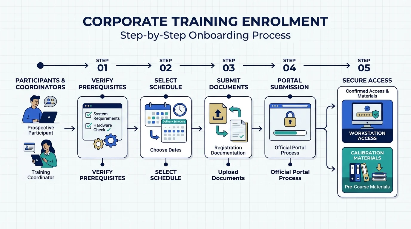
Institute For Oil & Gas Training maintains clear entry criteria to ensure all cohort participants operate at a compatible technical baseline, protecting instructional pace and peer collaboration quality.
Participant Eligibility and Prerequisites
The Borehole Image Logs for Fracture Detection Training Course is engineered for technical professionals actively involved in subsurface evaluation and well construction:
Target Roles: Petrophysicists, development geologists, exploration geologists, geomechanics specialists, reservoir engineers, and wellsite geologists.
Academic and Experience Baseline: A bachelor's degree in geoscience, petroleum engineering, or a related physical science, paired with at least one year of experience interpreting standard open-hole wireline logs.
Technical Readiness: Familiarity with basic structural geology concepts (dip, strike, stereonets) and fundamental petrophysical principles.
Step-by-Step Registration and Onboarding Process
Corporate HR managers and individual applicants follow a streamlined four-stage onboarding sequence:
Cohort and Format Selection: Choose between public workshop dates, live virtual sessions, or private corporate scheduling based on team size and operational calendars.
Technical Prerequisite Verification: Submit brief participant role profiles so instructors can calibrate software datasets to relevant geological basins (carbonate, clastic, or basement).
Administrative Confirmation: Complete corporate purchase order processing or individual tuition registration to confirm seat allocation and cloud workstation licensing.
Pre-Course Diagnostic Access: Receive digital course manuals, software installation guides, and baseline terminology checklists seven days prior to session commencement.
Certification and Completion Path
Participants who attend at least ninety percent of scheduled sessions and achieve a minimum score of eighty percent on the blind dataset evaluation receive formal technical certification from Institute For Oil & Gas Training. Graduates retain structured workflow checklists, quality control templates, and reference stereonet charts for ongoing operational use. Technical leads and individual practitioners ready to standardize subsurface fracture evaluation across their asset teams can enrol in the Borehole Image Logs for Fracture Detection Training Course directly through the corporate training portal.
Frequently Asked Questions
What is oil and gas borehole imaging used for in reservoir evaluation?
Oil and gas borehole imaging generates high-resolution electrical or acoustic maps of the borehole wall to identify natural fractures, sedimentary structures, and wellbore breakouts. Institute For Oil & Gas Training incorporates these datasets into technical workflows to help subsurface teams evaluate reservoir permeability, structural dip, and in-situ stress orientations with millimetre-scale accuracy.
How do acoustic and electrical borehole image logs differ?
Electrical borehole imaging tools measure micro-resistivity variations across the formation face and operate primarily in conductive water-based mud systems. In contrast, ultrasonic acoustic televiewers measure acoustic wave transit time and amplitude, making them effective for oil and gas borehole imaging in non-conductive oil-based mud environments.
How do geoscientists distinguish natural fractures from drilling-induced fractures?
Natural fractures appear as continuous sinusoidal traces crossing the entire borehole circumference and often exhibit varying aperture widths or mineral infilling. Drilling-induced tensile fractures appear as discontinuous, en-echelon vertical or sub-vertical features aligned with the maximum horizontal stress direction, a distinction taught in detail by Institute For Oil & Gas Training.
Who needs technical training in oil and gas borehole imaging?
Petrophysicists, development geologists, reservoir engineers, and geomechanics specialists require proficiency in oil and gas borehole imaging to reduce structural uncertainty during well placement and completion design. Institute For Oil & Gas Training structures its technical courses to equip subsurface asset teams with standardized log quality control, dip picking, and fracture characterization workflows.
Why is borehole image interpretation critical in carbonate reservoirs?
Carbonate reservoirs typically rely on secondary porosity networks—such as tectonic fractures, vugs, and karst features—rather than matrix porosity to conduct hydrocarbons. Accurate oil and gas borehole imaging enables engineering teams to quantify fracture intensity and orientation, preventing lost circulation during drilling and optimising well perforation intervals.
Related training courses
Borehole Image Analysis for Structural Geology Training Course
- Specialisation
- Oil & Gas Borehole Imaging
- Duration
- 5 days · 15 CPD hours
Borehole Image Applications in Wellbore Stability Analysis Training Course
- Specialisation
- Oil & Gas Borehole Imaging
- Duration
- 5 days · 15 CPD hours
Borehole Image Applications in Clastic and Carbonate Reservoirs Training Course
- Specialisation
- Oil & Gas Borehole Imaging
- Duration
- 5 days · 15 CPD hours
More articles
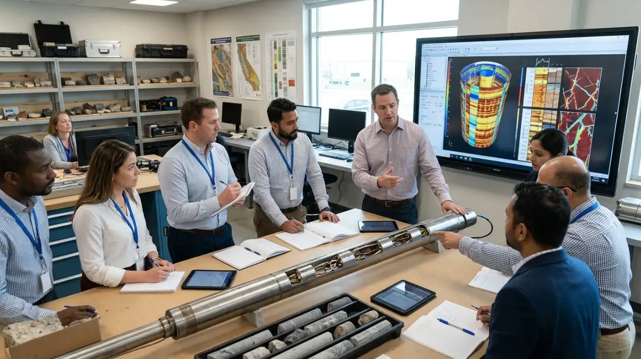
Electrical Borehole Imaging Technologies Training by Institute For Oil & Gas Training
Discover the curriculum, learning outcomes, and enrollment process for the Electrical Borehole Imaging Technologies Training Course.
Read article →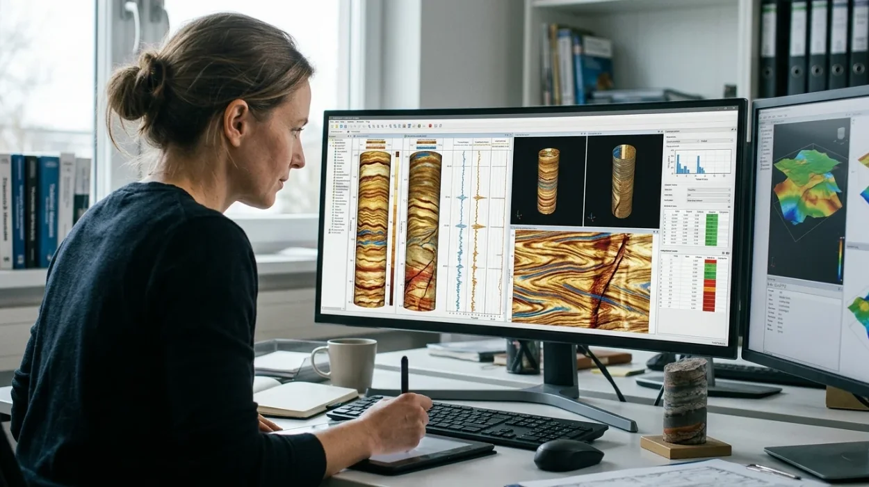
How to Evaluate Electrical Borehole Imaging Technologies and Their Applications in Formation Analysis
Master how to evaluate electrical borehole imaging technologies formation microimagers and resistivity logging tools for advanced subsurface analysis.
Read article →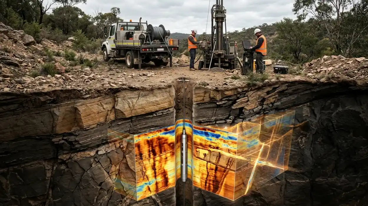
How Electrical Borehole Imaging Improves Subsurface Geological Understanding
Learn how electrical borehole imaging improves subsurface geological understanding and workforce competency through structured corporate technical training.
Read article →