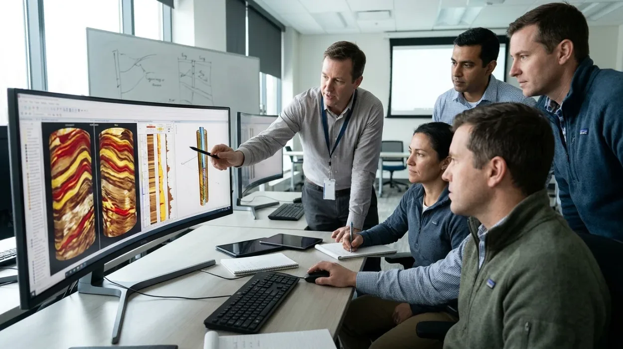
Subsurface asset teams frequently encounter high-resolution acoustic and resistivity log datasets that remain underutilised due to inconsistent manual picking and misidentified geological features. When geoscientists and petrophysicists lack standardised workflows for structural and stratigraphic analysis, reservoir models suffer from inaccurate fracture network predictions, flawed paleocurrent mapping, and miscalculated net-to-gross ratios. These technical errors directly increase well placement risks and inflate field development expenditure across upstream operations. To establish foundational awareness before evaluating advanced technical training, teams often examine Why Advanced Borehole Image Interpretation Matters in Subsurface Evaluation to understand the operational consequences of uncalibrated geological models.
What is the Advanced Borehole Image Interpretation Training Course and What Problem Does it Solve?
The Advanced Borehole Image Interpretation Training Course is a technical corporate training programme delivered by Institute For Oil & Gas Training that resolves subsurface geological uncertainty by standardising manual and automated dip picking, structural fracture classification, and depositional facies modelling.
Upstream exploration and production departments rely on borehole imaging tools to bridge the resolution gap between conventional wireline logs and physical core samples. Despite substantial capital investment in logging-while-drilling and wireline imaging acquisition, many operating companies experience a critical capability deficit during the post-acquisition interpretation phase. Junior and mid-career geoscientists often rely on default software parameters, leading to subjective dip classification and the misinterpretation of drilling-induced artifacts as natural geological features.
This technical inconsistency creates severe operational bottlenecks across multi-disciplinary asset teams. Reservoir engineers receive poorly constrained discrete fracture network inputs, while development geologists struggle to correlate sedimentary structures across offset wells. Learning and development managers and technical department heads require a structured training intervention that moves staff beyond basic software operation into rigorous geological problem-solving.
Institute For Oil & Gas Training designed this technical syllabus to eliminate interpretive variance across geoscience departments. The curriculum establishes repeatable quality control protocols for raw image processing, speed correction, and pad-to-pad normalisation. Participants learn to differentiate true geological boundaries from borehole breakouts, tensile fractures, and mud-cake anomalies before executing structural or stratigraphic workflows.
Core Subsurface Challenges Addressed
Ambiguous Dip Classification: Eliminates confusion between primary bedding interpretation and secondary tectonic deformation features through strict geometric and textural criteria.
Unreliable Fracture Characterisation: Establishes deterministic workflows to separate open, conductive fractures from cemented, resistive fractures and drilling-induced tensile cracks.
Disconnected Core-to-Log Integration: Trains specialists to calibrate high-resolution image facies against physical core descriptions to extend depositional models into uncored intervals.
Inconsistent Geomechanical Inputs: Standardises the identification of borehole breakout orientations and induced fracture azimuths to accurately constrain present-day maximum horizontal stress directions.
Why is This Borehole Image Interpretation Curriculum Structured This Way?
The curriculum follows a sequential cognitive progression from raw data quality control to integrated reservoir modelling, ensuring participants master foundational image physics and artifact removal before executing complex structural, sedimentological, and geomechanical workflows.
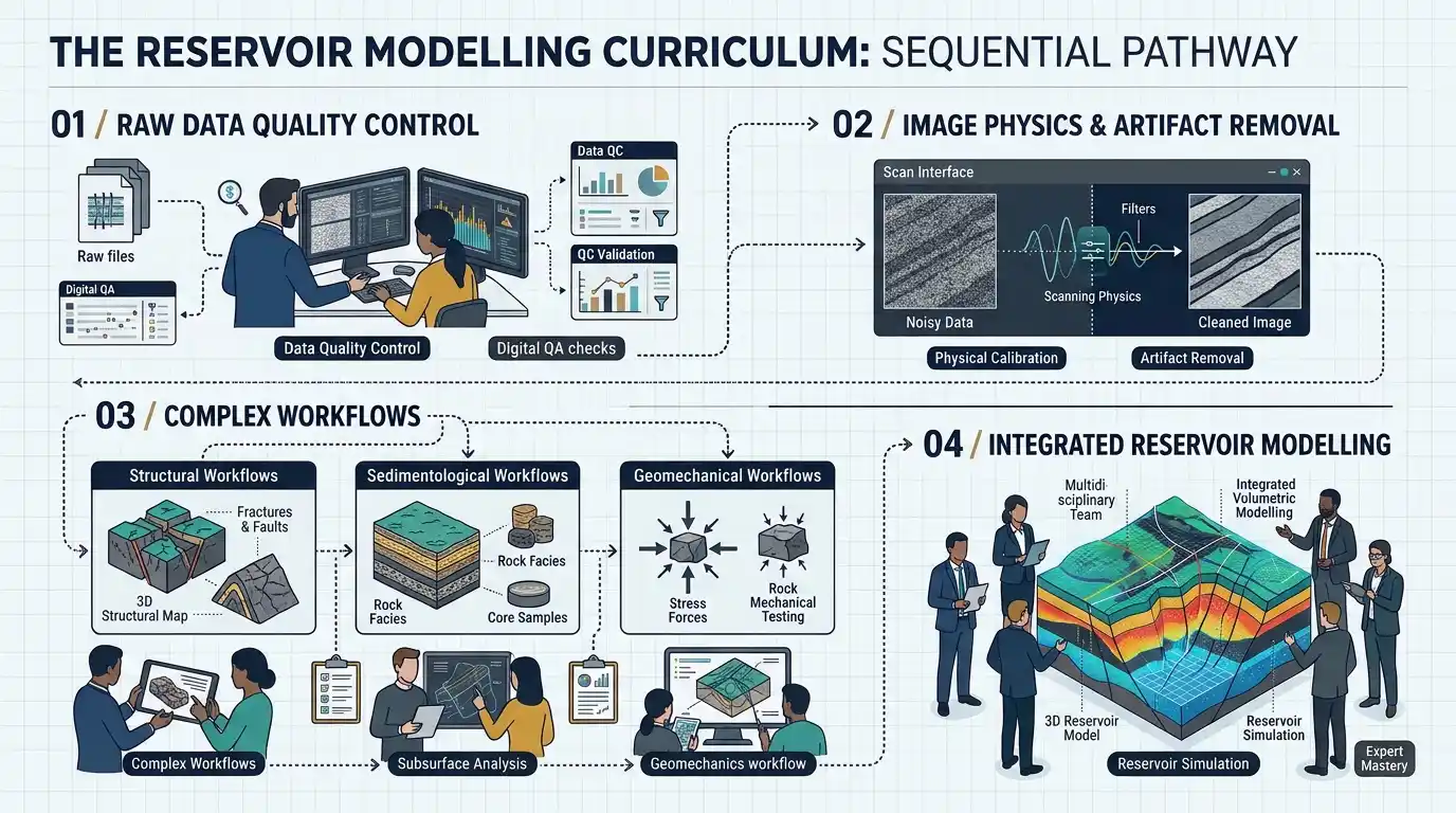
Effective technical upskilling requires a logical dependency chain where each analytical skill builds upon verified data integrity. Many commercial workshops fail to produce lasting workplace competence because they introduce advanced software automation before participants understand the underlying tool physics of micro-resistivity and ultrasonic acoustic imagers. When trainees skip raw log verification, they propagate acquisition errors directly into final geological models.
Institute For Oil & Gas Training structures the programme into five progressive capability tiers that mirror the actual lifecycle of a subsurface evaluation project. The learning architecture begins with tool physics and environmental corrections, ensuring every participant can audit vendor-processed deliverables. Once data integrity is established, the syllabus advances into geometric bedding interpretation and structural dip removal, which is a mandatory prerequisite for accurate stratigraphic restoration.
Following structural restoration, participants transition into depositional environment reconstruction and paleocurrent mapping. Only after mastering matrix and stratigraphic architecture do learners progress to complex fracture analysis and in-situ stress evaluation. For technical managers comparing training methodologies and evaluating how practical workflows integrate with existing departmental software, How to Apply Advanced Interpretation Techniques to Complex Borehole Image Data outlines the analytical progression required for multi-well field studies.
Pedagogical Design Principles
Physics-First Foundation: Ensures interpreters understand button current behaviour, acoustic transit time, and borehole fluid effects prior to touching interpretation workstations.
Artifact Isolation Before Feature Picking: Trains learners to systematically map drilling-induced features first so they are excluded from natural fracture statistics.
Progressive Complexity: Moves from simple clastic layer-cake sequences to structurally complex carbonate reservoirs and fractured basement plays.
Software-Agnostic Methodology: Focuses on geological principles and mathematical dip calculations applicable across all industry-standard workstation platforms.
What Will Participants Learn in the Advanced Borehole Image Interpretation Training Course?
Participants will master five core technical modules covering image quality control, structural dip analysis, clastic and carbonate sedimentology, quantitative fracture characterisation, and integrated reservoir characterisation using real-world multi-well datasets.
The syllabus translates theoretical geological concepts into executable workstation routines. Every module pairs concise technical instruction with structured practical exercises using authentic field data from clastic, carbonate, and unconventional reservoirs. Human resources directors and technical leads can audit exact skill acquisition through clearly defined module deliverables.
Module 1: Tool Physics, Processing, and Quality Control
Participants examine the operational mechanics of wireline micro-resistivity, ultrasonic acoustic, and logging-while-drilling imaging sensors. Learners execute step-by-step quality control checks on accelerometer and magnetometer curves to detect tool sticking, eccentering, and magnetic interference. The module covers static and dynamic normalisation techniques, dead-button interpolation, and speed correction adjustments necessary to produce distortion-free borehole images.
Module 2: Structural Dip Analysis and Structural Restoration
This module establishes strict protocols for manual sinusoid fitting and automated dip-picking calibration. Participants classify planar features by confidence levels and generate stereonets, tadpole plots, and cumulative dip plots to identify structural domains, unconformities, and fault drag zones. Learners perform structural dip removal to restore tilted strata to their original depositional horizontal plane.
Module 3: Sedimentological Analysis and Paleocurrent Mapping
Learners identify internal sedimentary structures including cross-bedding, ripple lamination, graded bedding, bioturbation, and slump folds across diverse depositional settings. Using structurally restored dip azimuths, participants execute paleocurrent mapping to determine sediment transport directions, channel sand body orientations, and shoreline geometries. The module includes rigorous core-to-image electrofacies calibration exercises for uncored well intervals.
Module 4: Quantitative Fracture Analysis and Geomechanics
Participants distinguish natural open fractures, healed fractures, vugs, and stylolites from drilling-induced tensile fractures and borehole breakouts. Learners calculate fracture aperture, fracture intensity (P10, P21, P32), and orientation sets across distinct mechanical stratigraphic units. The training integrates breakout azimuths with mud weight logs and leak-off tests to construct reliable present-day stress profiles for wellbore stability modelling.
Module 5: Integrated Reservoir Characterisation and Static Model Input
The final module synthesises structural, sedimentological, and fracture outputs into unified static reservoir characterisation deliverables. Participants generate upscaled electrofacies logs, fracture permeability tensors, and net-to-gross profiles formatted for direct import into three-dimensional geomodelling software. Learners complete a capstone multi-well integration project demonstrating how image log insights alter volumetric estimates and horizontal well trajectories.
How is the Course Delivered and Assessed by Institute For Oil & Gas Training?
Institute For Oil & Gas Training delivers the course through flexible five-day instructor-led workshops, live virtual classrooms, or onsite corporate cohorts, evaluating technical competence via daily workstation exercises, diagnostic quizzes, and a multi-well capstone simulation.
Corporate training schedules must accommodate active operational rosters without disrupting ongoing drilling or field development commitments. Institute For Oil & Gas Training offers three structured delivery configurations to align with corporate workforce distribution and departmental budgets. All formats maintain identical technical rigour, instructor-to-participant ratios, and workstation exercise hours.
Delivery Format | Duration | Schedule Structure | Ideal Corporate Use Case |
Onsite Corporate Cohort | 5 Consecutive Days | 8 hours per day (40 total hours) at client facility | Upskilling intact asset teams using proprietary company well datasets |
Live Virtual Instructor-Led | 10 Half-Days | 4 hours per day over two weeks (40 total hours) | Geographically dispersed regional teams requiring minimal operational downtime |
Open-Enrollment Workshop | 5 Consecutive Days | 8 hours per day (40 total hours) at regional hubs | Individual specialists, newly hired geoscientists, and cross-company benchmarking |
Training Methodologies and Workstation Practice
Instruction follows a 30/70 split between technical lecture delivery and hands-on workstation application. Lead instructors are practising senior structural geologists and petrophysicists with extensive global basin experience. Participants work directly with multi-well datasets containing raw imaging curves, conventional open-hole logs, core photographs, and mud log data.
Competency Assessment Framework
To satisfy corporate training governance and provide measurable return-on-investment metrics for human resources teams, Institute For Oil & Gas Training enforces a multi-stage assessment framework:
Baseline Diagnostic Assessment: A pre-course technical evaluation measures existing proficiency in dip geometry, log physics, and structural geology to calibrate instructional pacing.
Daily Workstation Deliverables: Participants submit interpreted tadpole plots, electrofacies schemes, and fracture intensity logs at the conclusion of each module for instructor verification.
Artifact Identification Audit: A timed practical test evaluates the learner's ability to accurately separate drilling-induced features from natural geological structures under operational deadlines.
Capstone Reservoir Evaluation: Learners present a complete multi-well geological interpretation report defending their reservoir characterisation conclusions to a technical review panel.
What Measurable Results Can Organizations Expect After Completion?
Organizations achieve measurable reductions in subsurface interpretation turnaround times, higher accuracy in discrete fracture network modelling, standardised multi-well reporting across asset teams, and documented capability progression for corporate technical career ladders.
Investing in the Advanced Borehole Image Interpretation Training Course generates immediate operational improvements across exploration, appraisal, and development workflows. Rather than relying on external consultants for routine image log processing, internal geoscience teams gain the autonomy to execute complex interpretations in-house. This internal capability retention protects proprietary subsurface data and accelerates decision-making during active drilling campaigns.
Workplace Performance and Departmental Impact
Standardised Technical Governance: Geoscience departments establish a unified dip-picking and fracture-classification lexicon, eliminating conflicting interpretations between different asset teams working on adjacent blocks.
Improved Well Placement Precision: Development geologists utilise accurate paleocurrent mapping and structural dip models to steer horizontal wells within optimal reservoir facies and intersect productive open fracture networks.
Reduced Non-Productive Time: Drilling engineers receive verified in-situ stress orientation profiles derived from borehole breakout analysis, supporting safer mud-weight window design and preventing wellbore collapse.
Accelerated Onboarding Velocity: Human resources and technical learning managers integrate the course into structured competency frameworks, reducing the time required for junior geologists to reach independent operational sign-off.
Real-World Corporate Application Examples
Exploration Asset Teams: Following completion of the programme by twelve staff geologists, an offshore exploration department internalised its clastic bedding interpretation workflows, reducing third-party interpretation vendor expenditure while cutting post-well evaluation timelines by three weeks.
Carbonate Reservoir Engineering Groups: Petrophysicists and reservoir engineers trained by Institute For Oil & Gas Training calibrated acoustic image fracture intensity logs against production logging tool data, resolving historical water-breakthrough anomalies in a mature fractured carbonate field.
Corporate Learning and Development Pipelines: Energy sector human resources teams deploy this syllabus as a mandatory milestone within senior geoscientist promotion tracks, using the capstone assessment score as an objective technical proficiency metric.
How Does Enrollment Work for Individuals and Corporate Teams?
Enrollment requires prerequisite familiarity with basic petrophysics and structural geology, proceeding through a streamlined four-step registration, technical pre-assessment, workstation provisioning, and cohort scheduling workflow managed directly by Institute For Oil & Gas Training.
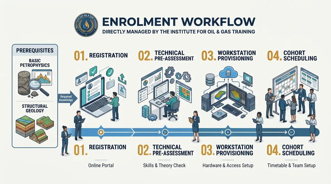
To maintain an advanced instructional pace without revisiting introductory well-logging concepts, Institute For Oil & Gas Training enforces clear technical entry criteria. Corporate training coordinators and individual applicants can verify eligibility and secure cohort placement through a structured administrative process.
Eligibility and Technical Prerequisites
Academic and Professional Background: Applicants must hold a degree in geology, geophysics, petroleum engineering, or a related earth science discipline, with at least one year of subsurface operational experience.
Foundational Log Literacy: Participants must be proficient in reading standard triple-combo wireline logs (gamma ray, resistivity, density-neutron) and basic geological cross-sections.
Software Readiness: For virtual cohorts, participants require workstation access to industry-standard borehole image interpretation software or pre-configured cloud workstation credentials provided prior to course commencement.
Step-by-Step Enrollment and Completion Path
Candidate Verification and Cohort Selection: Individual professionals or corporate training managers select their preferred open-enrollment dates or request dedicated onsite cohort scheduling through Institute For Oil & Gas Training.
Pre-Course Technical Diagnostic: Confirmed registrants receive a brief online diagnostic questionnaire to verify baseline structural geology knowledge and identify specific reservoir types (clastic, carbonate, or unconventional) relevant to their current role.
Dataset and Workstation Provisioning: Seven days prior to the start date, participants receive the digital training manual, multi-well log datasets, and software environment verification instructions.
Course Execution and Certification: Learners complete all forty instructional hours, pass the daily workstation audits, and deliver the final capstone interpretation project to earn an accredited technical completion certificate from Institute For Oil & Gas Training.
Technical managers, human resources coordinators, and individual geoscientists ready to schedule upcoming cohorts or secure seats for their subsurface teams can enroll in this program to initiate participant registration and workstation provisioning.
Frequently Asked Questions
What is Oil & Gas Borehole Imaging used for in reservoir evaluation?
Oil & Gas Borehole Imaging generates high-resolution electrical and ultrasonic representations of the borehole wall to identify bedding dips, natural fracture networks, sedimentary structures, and in-situ stress orientations. At the Institute For Oil & Gas Training, specialists learn to integrate these image logs with core data and conventional wireline measurements to improve reservoir characterisation and well placement accuracy.
What is the difference between acoustic and resistivity borehole imaging logs?
Resistivity imaging tools measure micro-electrical variations across the formation using pad-mounted buttons, making them ideal for high-resolution stratigraphic and fracture analysis in conductive drilling muds. Conversely, ultrasonic acoustic imagers emit sound waves to record transit time and reflection amplitude around the full wellbore circumference, operating effectively in oil-based muds and providing detailed borehole geometry and breakout measurements.
How do geoscientists distinguish natural fractures from drilling-induced fractures on image logs?
Natural fractures typically cut continuously across the borehole wall as complete sinusoidal curves and may appear either conductive or resistive depending on whether they are open or mineral-filled. Drilling-induced tensile fractures appear as discontinuous, narrow vertical or en-echelon features oriented 180 degrees apart along the maximum horizontal stress direction, a distinction emphasised throughout Oil & Gas Borehole Imaging modules at the Institute For Oil & Gas Training.
Who should enrol in Oil & Gas Borehole Imaging training courses?
Oil & Gas Borehole Imaging programmes at the Institute For Oil & Gas Training are designed for development geologists, exploration geoscientists, petrophysicists, reservoir engineers, and drilling specialists responsible for subsurface evaluation. Participants typically hold a foundational understanding of petroleum geology and standard open-hole well logging principles.
How does borehole image interpretation reduce operational risks during drilling?
Accurate borehole image interpretation constrains present-day horizontal stress directions from borehole breakouts and induced fractures, enabling drilling engineers to optimise mud-weight windows and prevent wellbore instability. Structured Oil & Gas Borehole Imaging workflows taught by the Institute For Oil & Gas Training also refine paleocurrent mapping and structural dip models to steer horizontal wells within optimal pay zones.
For a visual walkthrough of wireline resistivity image interpretation and field applications, watch the Introduction to Borehole Imaging and case study presentation, which demonstrates practical subsurface evaluation concepts.
Related training courses
Borehole Image Acquisition and Tool Selection Training Course
- Specialisation
- Oil & Gas Borehole Imaging
- Duration
- 5 days · 15 CPD hours
Borehole Image Applications in Sedimentology Training Course
- Specialisation
- Oil & Gas Borehole Imaging
- Duration
- 5 days · 15 CPD hours
Borehole Image Applications in Wellbore Stability Analysis Training Course
- Specialisation
- Oil & Gas Borehole Imaging
- Duration
- 5 days · 15 CPD hours
More articles
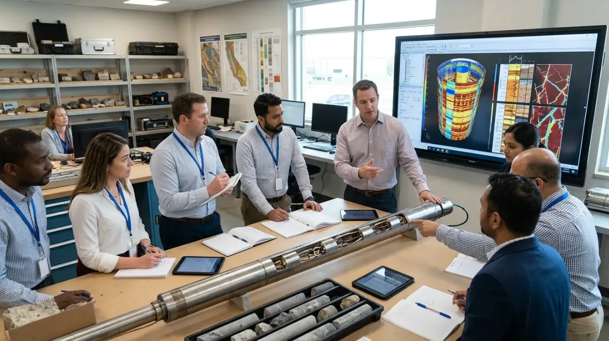
Electrical Borehole Imaging Technologies Training by Institute For Oil & Gas Training
Discover the curriculum, learning outcomes, and enrollment process for the Electrical Borehole Imaging Technologies Training Course.
Read article →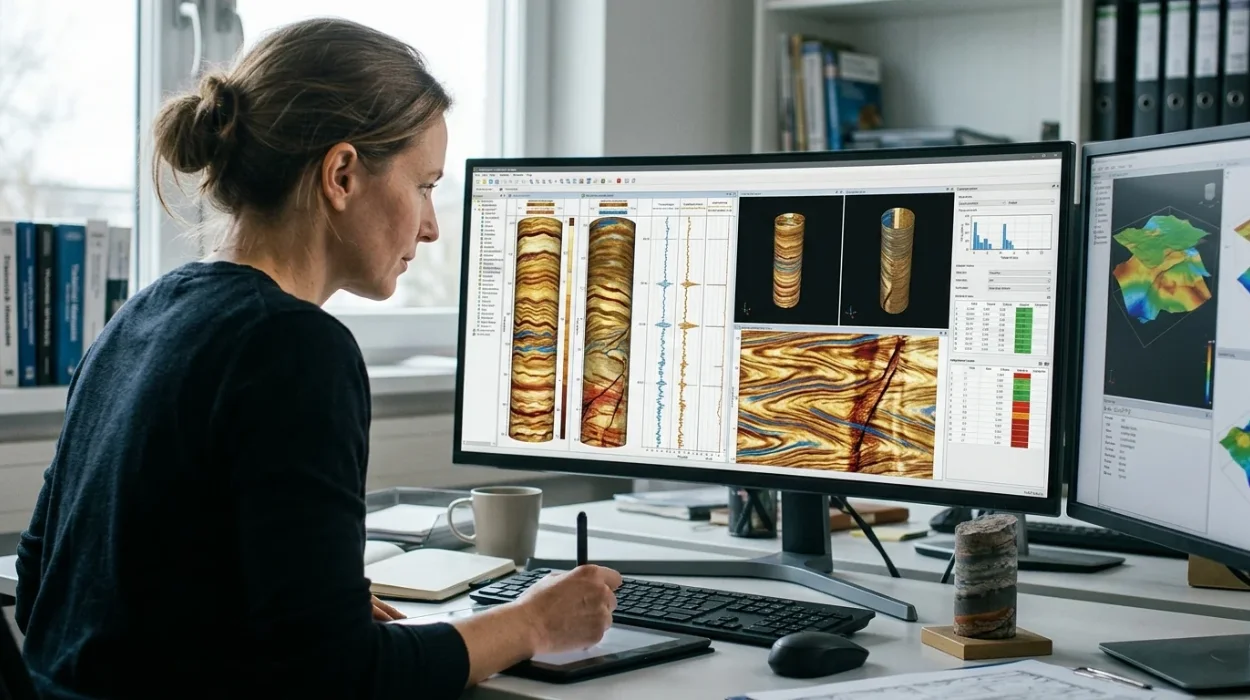
How to Evaluate Electrical Borehole Imaging Technologies and Their Applications in Formation Analysis
Master how to evaluate electrical borehole imaging technologies formation microimagers and resistivity logging tools for advanced subsurface analysis.
Read article →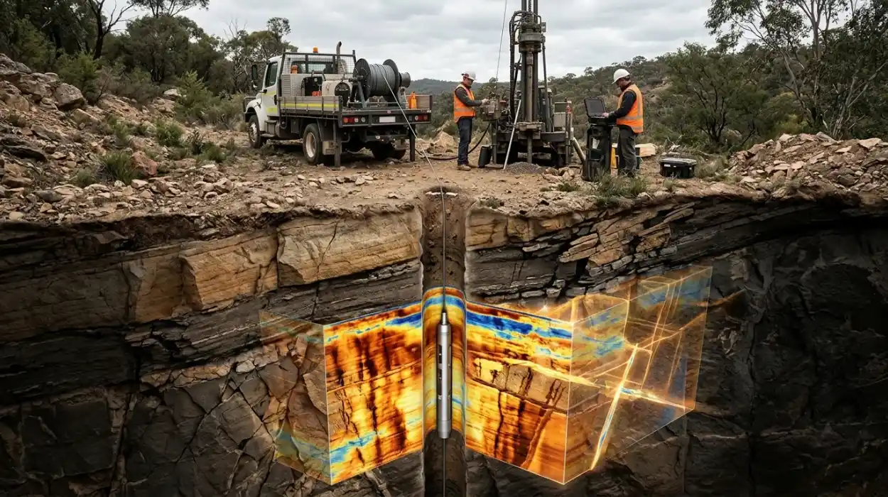
How Electrical Borehole Imaging Improves Subsurface Geological Understanding
Learn how electrical borehole imaging improves subsurface geological understanding and workforce competency through structured corporate technical training.
Read article →